After 10 days rest and recovery, we finally pack our bags and bicycles and once again head off south. Our route will take us up and into Cotopaxi National Park, where we’ll hopefully catch a glimpse of the majestic Cotopaxi volcano. At 5,897m high it’s glaciated cone shaped peak is highly active and looks beautiful in the pictures. Friends who are cycling ahead of us have shared pictures with us, they were lucky enough to get views both day and night, I only hope we are fortunate enough to see the same.
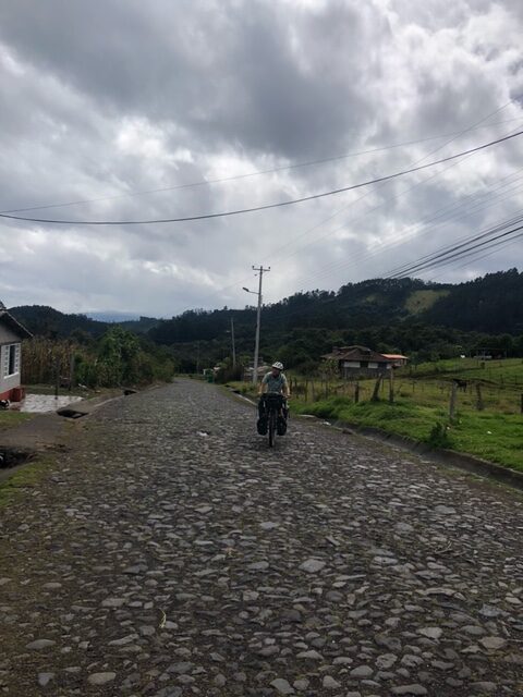
We follow the road for the first 15 miles, staying east of an inactive volcano Ilalo, before turning left off the main roads and heading up a very steep pass for about 400m before this levels out a bit and turns into cobbles!
I’d read about the famous Ecuadorean cobbles before we’d left but I hadn’t given it much thought. Now here faced everyday by these cobbles, which to be fair must have been an amazing feat of engineering and a lot of hard work to lay down, on a bike they’re incredibly painful on the backside and they slow you down to a snails pace! At one point I’m moving so slowly, I notice my odometer is registering 0mph, it must think I’ve stopped!
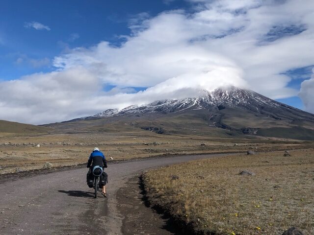
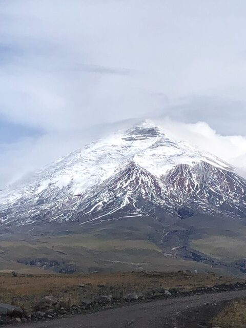
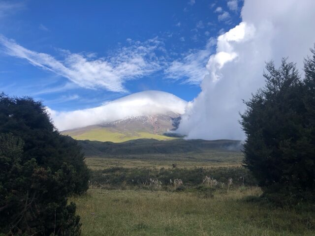
We cycle uphill on these cobbles for a long 15 miles, we start off in bright sunshine, but soon enough we’re putting our waterproofs on as the cloud and rain rolls in. In the afternoon the rain clears and the cloud starts to lift and eventually we turn a corner and I catch a glimpse of Cotopaxi, shrouded in mist and covered in snow! Through the cloud it looks majestic but also menacing, I certainly wouldn’t want to be attempting to reach the summit in these conditions!
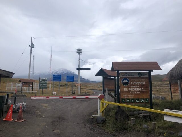
We stop for lunch at a Mirador car park with a small cafe, which surprisingly serves a vegetarian dish of corn on the cob, green beans and big lumps of cheese – it was delicious and warmed us up. We carry on and the road changes from cobbles to dirt road which is slightly more pleasant on the numb backside, and before long we reach the entrance to the National park. It’s free to enter but you have to arrive before 3pm, it’s 2.15pm as we show the guard our passports and we cycle through. The cloud continues to lift and it feels good to see some lie sky and feel the warmth of the sun, although at 3700m the wind makes sure we don’t get to take our jackets off!
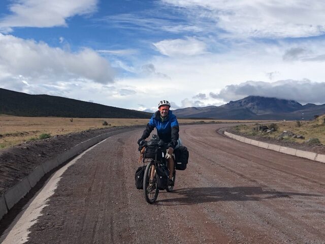
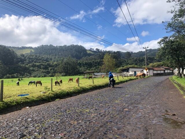
In the park the landscape opens up, and you can start to see where the many eruptions over the years have left their mark, giant boulders sit overlooking the vast plain as the wind gently blows the many beautiful wildflowers I imagine survive up here due to the quality of the volcanic ash. To our right is Ruminahui, a dormant 4700m volcano and straight ahead of us now is an almost clear Cotopaxi. It’s stunning to look at, a plume of cloud covering its cone shaped top. Cycling through this quiet landscape is beautiful, but I’m aware time is getting on and we need to find one of the 3 official campsites before it gets dark. We finally hot our high point at 3850m, this is the highest altitude I’ve ever cycled at so far, and I’m feeling tired and ready for a break. We descend two or three miles before reaching the campsite, a secluded forested area with no one else there, with views of Cotopaxi!
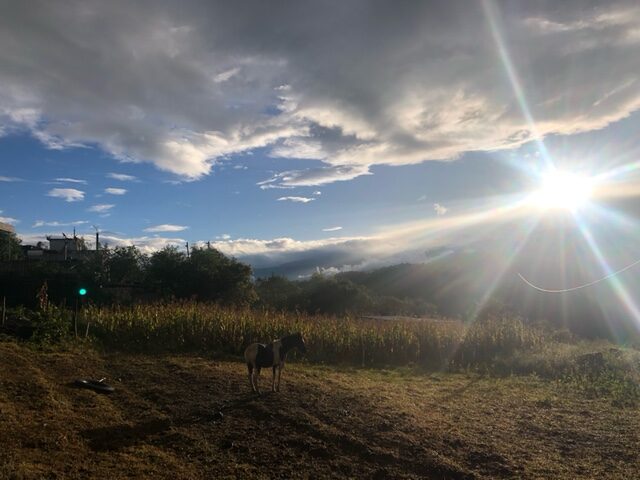
We set up camp surrounded by curious wild horses and cook dinner under the watchful eye of Cotopaxi. At about 7pm it’s dark and it starts to get cold so we retreat to our tent to keep warm. In the morning I wake up hopeful for a beautiful morning view of Cotopaxi but there’s so much cloud cover it’s difficult to see the wild horses 10m away! We pack up, put on all our layers and descend the 15 miles to the nearest town, Lasso. It would have been a beautiful long winding descent through the forest on a decent road, but it was so cold we had to go fairly slowly to stop our fingers and toes freezing! We eventually headed out of the National park gates and stopped at their cafe for a hot chocolate to warm up. We continued into Lasso and found a place nearby with some simple Cabins to stay overnight in.
I felt exhausted, it was an amazing experience and not one I regret, but I still felt I hadn’t quite recovered from my recent illness, and the combination of hard cycling at altitude and the cold weather was just making me worse. Even at the cabin that night at 3000m it was cold and we slept under 5 blankets. There next day was equally cloudy and cold, and I felt no better. Chris was also suffering, and so after long discussions we decided to skip the next section of our planned route, which would mean missing Quilotoa Laguna and also cycling alongside Chimborazo, the highest mountain in Ecuador. It was disappointing but also felt like the right decision. I was so exhausted I really wasn’t enjoying myself at the minute, and was starting to wonder what I was doing. Colombia had felt like such an experience, wild and free, but the past few weeks in Ecuador I’d just felt tired and homesick.
That same morning I received news that my good friend had passed away. It’s such a shock and being so far away it felt very surreal. This made everything worse, we carried on cycling but I’d completely lost motivation and was struggling to see the beauty in everything.
As usual, after struggling to deal with my own negative thoughts I eventually confide in a good friend, and a problem shared is immediately a problem halved. I talk to Chris about how I’m feeling and he says he’s also been struggling with exhaustion. We agree the best solution is to change our route and head east into the Amazon, once again dropping from high altitude into the warmer rainforest. It feels good to be able to change our route to make us happier, and important to remember why we’re on this journey.
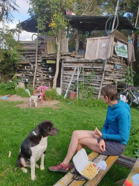
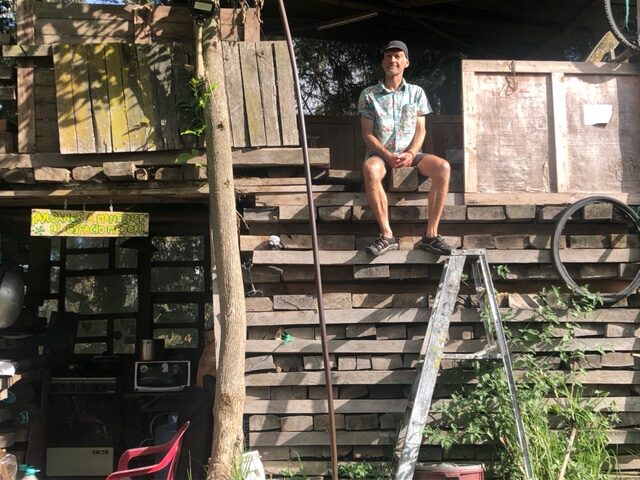
We head south and stay one night at a quirky type of case de ciclista, a place where you can camp with basic facilities. There’s a tree house where we put our tent under the roof, and the 4 dogs and one cat which seems to be the boss, follow us around as we set up camp and make dinner. We’re still at 2700m here and in the morning it’s clear but cold. In the distance I can just about see Cotopaxi’s conical peak bursting out of the clouds below.
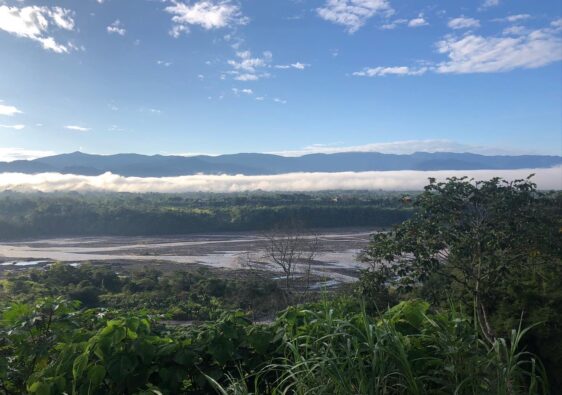
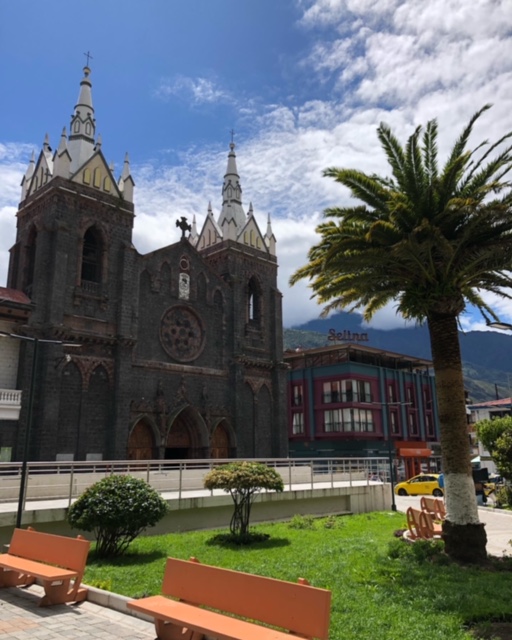
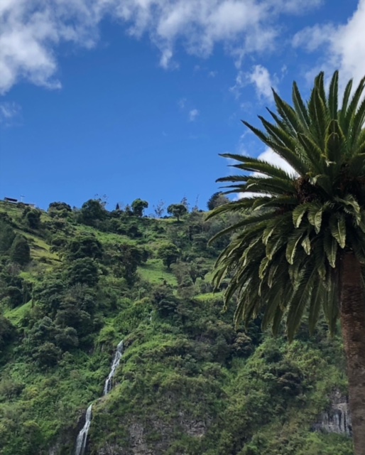
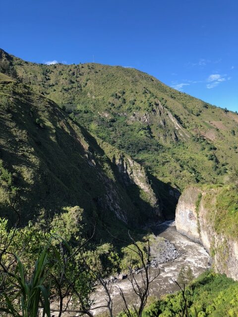
We pack up and carry on, soon turning east and undulating up winding hills until we eventually reach our high point, then it’s a long smooth 15 miles descent (mainly) into Banos. Banos is wedged between steep sided lush green valleys and the river Pastaza, with many tributaries flowing into it on the way. We stay in a quiet hostal just outside of town, right next to the fast flowing river deep below in the canyon. At 1800m it’s the perfect climate, not too hot but not cold either. We spend three nights here, and although it’s a touristy destination with so many different outdoor activities I would normally be keen to do, we do nothing but wander slowly around town, drinking coffee in the sun and sampling nice local foods! It feels good to rest at this altitude and we start to feel rejuvenated.
From here our plan is to keep dropping down the valley and into the Amazon, then head south through the Amazon until eventually we’ll climb back into the Andes and up into Loja, a green city in southern Ecuador.